Brda
Trip duration: 8-10 days (for the whole trail length). Difficulty: (1) 
River length 239 km / 233 km trail length
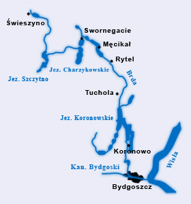
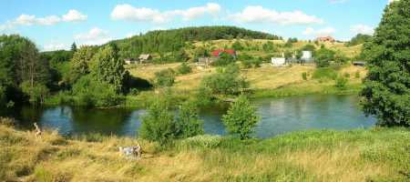
The Brda is considered to be the most interesting and most varied canoe trail in Poland. It is a left tributary of the Vistula River. The river is 239km long. The Brda basin consists of 43 rivers and numerous lakes. It is one of the most popular Polish canoeing rivers and is accessible to beginner tourists. The picturesque landscape of the Brda includes the “Tucholski Forests” National Park and Zaborski and Tucholski Landscape Parks. The Brda’s attraction is mainly characterised by beautiful lakes with clear water and varying, mostly wooded, shore lines. The whole canoe trail is marked. An additional advantage are numerous accommodation sites (both campsites and rural tourism) and dining options located in most towns along the trail.
 Proposed daily runoff distances on the Brda river:
Swieszyno – Stara Brda – 10 km
Stara Brda – Nowa Brda – 14 km
Nowa Brda – Pakatulsko – 14 km
Pakatulsko – Sapolno – 21 km
Sapolno – Swornegacie – 19 km (our base)
Swornegacie – Mylof – 23 km
Mylof – Brda – 18 km
Brda – Golabek – 19 km
Golabek – Swit – 14 km
Swit – Gostycyn-Nogawica – 12 km
Distances from Swornegacie (for kayak and canoe delivery):
Swieszyno – 50 km
Stara Brda – 45 km
Zolna – 40 km
Nowa Brda – 35 km
Garbaty Most – 30 km
Pakotulsko – 25 km
Przechlewo – 23 km
Plaszczyca – 20 km
Sapolno – 15 km
Ciecholewy – 10 km
Male Swornegacie – 10 km
Swornegacie (our base) – 0 km
Drzewicz – 5km
Czernica – 15 km
Mecikal – 20 km
Mylof – 25 km
Rytel – 30 km
Brda – 45 km
Woziwoda – 60 km
Plaskosz – 60 km
Golabek – 60 km
Tuchola Rudzki Most – 57 km
Swit – 60 km
Gostycyn Nogawica – 70 km
Sokole Kuznica – 85 km
Samociazek – 100 km
Bydgoszcz – 110 km


