


Drawa

River length 186 km / 173 km trail length
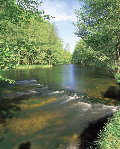
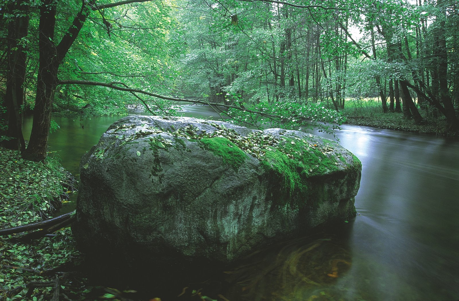
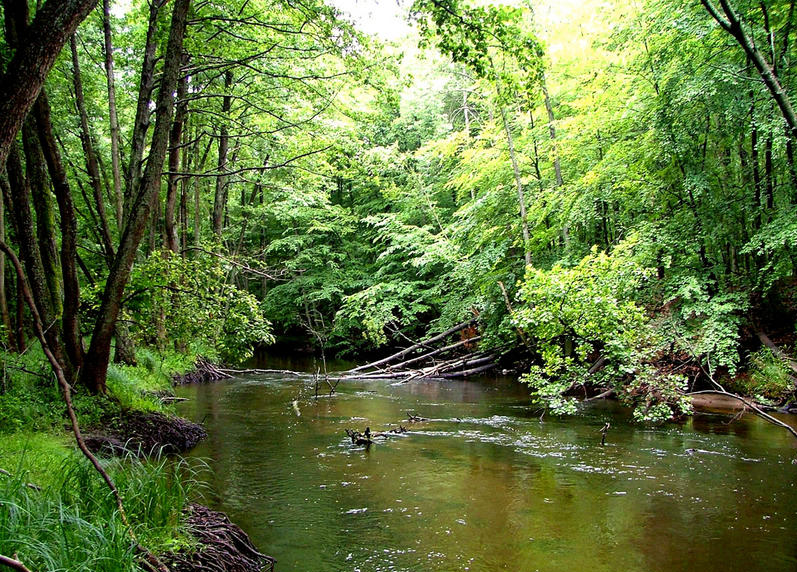
The source of Drawa is near the village of Zdroje, in the municipality of Polczyn-Zdroj in the Drawski Landscape Park. It is the second largest tributary of the Notec. In the upper reaches it flows through the Valley of the Five Lakes, connecting Lakes Gome, Krag, Dlugie, Glebokie and Male, and then flows through Lakes Prosino, Zerdno, Drawsko, Rzepowskie, Krosino, Lubie, Wielkie and Male Debno. Up to the town of Drawsko Pomorskie the river is protected under the Drawski Landscape Park. On the stretch between Lake Wielkie Dabie and the Borowo hydroelectric power plant the river flows through part of the Drawski military training area. Use of this section of the the Drawa is prohibited.
The trail is divided into two parts: the upper up to Lake Lubie – pretty easy, although requiring kayaking and canoeing through reeds – and the lower part, requiring more experience, which is quite difficult with swift currents, which goes through the Drawski National Park. From February up to the end of June the second part is closed to kayakers and canoeists.
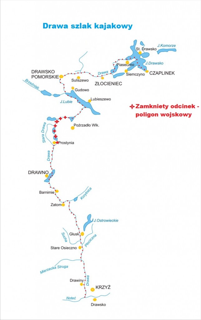
Proposed daily runoff distances on the Drawa river:
Czaplinek – Rzepowo – 14 km
Rzepowo – Rzesnica – 15 km
Rzesnica – Drawsko Pomorskie – 13 km
Drawsko Pomorskie – Island Rybaki (Lake Lubie) – 14 km
Island Rybaki – Lake Wiry – 18 km (end of upper part of Drawa due to military traning area – 24 km carryover to Prostynia)
Prostynia – Roscin – 6 km
Roscin – Drawno – 10 km
Drawno – Barnimie – 11 km
Barnimie – Bogdanka – 10 km
Bogdanka – Pstrag – 15 km
Pstrag – Stare Osieczno – 11 km
Stare Osieczno – Przeborowo – 16 km
Przeborowo – Krzyz -10 km
Distances from Swornegacie (for kayak and canoe delivery):
Czaplinek – 110 km
Stare Drawsko – 115 km
Rzepowo – 120 km
Głęboczek – 120 km
Złocieniec – 125 km
Dalewo – 135 km
Drawsko Pomorskie – 145 km
Mielenko Drawskie – 145 km
Gudowo – 140 km
Lubieszewo – 135 km
Żołędowo – 170km
Prostynia – 160 km
Drawno – 170 km
Barnimie – 175 km
Konotop – 175 km
Jaźwiny – 175 km
Moczele – 175 km
Głusko – 175 km
Stare Osieczno – 165 km
Przeborowo – 195 km
Łokacz Wielki – 185 km
Krzyż Wielkopolski – 185 km