


Radunia
Trip duration: 6-7 days (for the whole trail length). Difficulty: (2) 
River length 104 km / 96.5 km trail length
The Radunia is a left tributary of the Motlawa. The total length of the river is 104 km, with a total drop of 162 m. The river flows from the lower area (with a length of approximately 4 km) next to Lake Stezyce at an altitude of 165 m above sea level and flows through a complex of lakes called the “Circle Radunskie” Kashubian Lake District. The Radunia has the characteristics of an upland river, with up to 6.80% being in the Babidolski turn. It joins the Motlawa in the area of Zulawy around the town of Krepiec (near Gdansk).
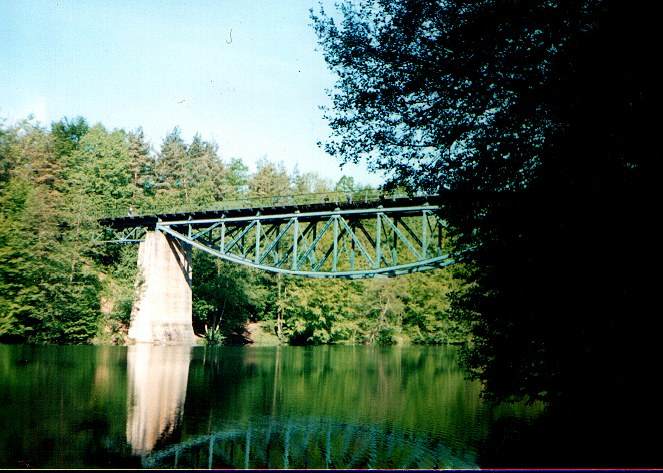
In the years 1910-1937 eight hydroelectric power plants were built on the Radunia. These plants, which are still in use today, are valuable monuments of pre-war industrial architecture and are open to the public.
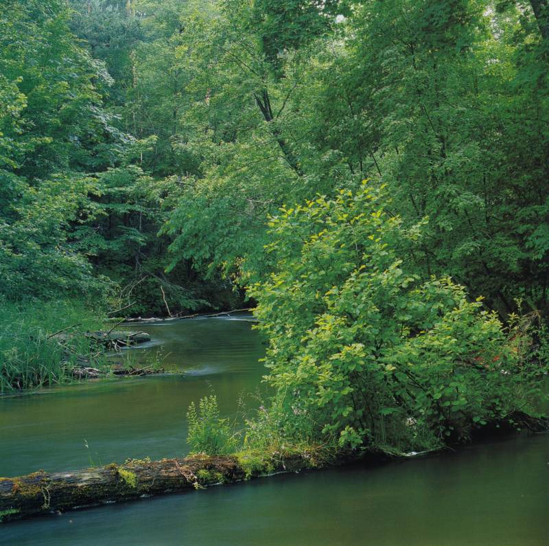
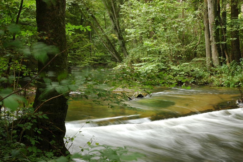
Both the “Radunskie Circle” and the river itself are suitable for kayaking and canoeing. The upper section of the trail is easy, with a small number of carryovers. It is mostly kayaking and canoeing on the lakes, ideally suited for novice kayakers. In contrast, the middle section is in a mountain range and requires a lot of experience. From Zukowo begins the least frequented stage, with lots of carryovers.
Between the village of Kielpino and the Rutka power plant the river flows in the beautiful Babidolski turn where the reserve called the “Radunia River Canyon” was established . From Pruszcz Gdanski part of the Radunia (approximately 10 km) flows through the natural channel of Zulawy Gdanskie, whilst the rest of the water is diverted through the Radunia Canal, built in the years 1348 to 1354 by the Teutonic Knights.
Proposed daily runoff distances on the Radunia river:
Radunskie Circle – (Stezyca – Ostrzyce)
Ostrzyce – Zukowo
Zukowo – Kolbudy
Kolbudy – Pruszcz Gdanski
Pruszcz Gdanski – Gdansk
Distances from Swornegacie (for kayak and canoe delivery):
Stężyca – 70 km
Ostrzyce – 80 km
Żukowo – 95 km
Kolbudy – 100 km
Pruszcz Gdański – 120 km
Gdańsk – 115 km